requiring balance, hopping, pogo-action, traction control, or other bike-handling skills.
requiring sustained heart rates and a high lung capacity.
requiring leg power and upper body development.

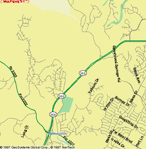
This is park of well worn trails along Route 360 in west Austin.
The park boundaries adjoin Cat Mountain trails on the
east side of Route 360 and the
Jester Mountain or
High Ridge
trails on the west side.
There are many well travelled trails in Bull Creek Park. This is a good place for meeting many experienced mountain bikers.
Great fun and danger can be had following rain storms. Since Bull Creek is firmly embedded in limestone rock, there is little problem with erosion or trail damage. Be prepared to get wet. However, note that there is great danger in riding in ragin streams, especially after the rains such as the one we have had in June of 1997.
If you get tired of the Bull Creek trails, try Jester Mountain or High Ridge trails on the west side of Route 360 (just go up the mountain) or explore Cat Mountain on the east side.
| Technical requiring balance, hopping, pogo-action, traction control, or other bike-handling skills. | Aerobic requiring sustained heart rates and a high lung capacity. | Strength requiring leg power and upper body development. | |
|---|---|---|---|
| Ascents | - | - | - |
| Level ground | 
| - | - |
| Descents | - | - | - |
Loop 360, 2 miles north of FM 2222, 2 miles south of Route 183.

3 miles of linear hiking trails, stream beds, mostly single track.
80% rocky limestone with exposed bolders, shelves, and ledges. 20% hard packed dirt. Lots of Bull Creek stream to ride in.
None unless you venture up Cat Mountain or Jester Mountain.